Data Management & Visualization
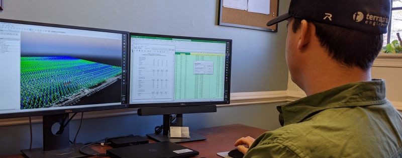


Transforming data into decisions
Our tools and expertise make a difference to our clients, whether they aid in conducting evaluations, help to gain insights, or ultimately drive solutionsData Management: Data serves as the cornerstone for an environmental project. Our experts manage and apply data to scientific and engineering challenges and will treat your data as one of your most valuable strategic assets. READ MORE
- Expertise in industry data management systems, including Microsoft Access® SQL Server®, ESdat Environmental Data Management System™ and Earthsoft EQuIS™
- Mobile data collection tools that are integrated with our data management systems to help guide projects in real-time from the field (see smart data proj desc link at bottom…)
- Data management plans that help define team member roles and outline clear Data Quality Objectives (DQO’s) that can mean the difference between success and failure for a project
- Standard Operating Procedures that foster efficient data management and retrieval
- Automated cleaning and compilation of disparate data from multiple sources using Python Programming
Data Analysis and Statistics: Terraphase uses a wide array of tools to perform data analysis to meet project objectives. We transform environmental data into work products that support risk management decisions and guide investigations. READ MORE
- EPA’s ProUCL for confidence levels, statistical pattern recognition and trend detections
- Python programming tools such as pandas and NumPy for processing and data reduction of time series data, such as well transducer readings
- Automated exploratory data analysis, statistics, and data mining using Python programming and open source libraries such as Orange, pandas, and NumPy
- Multivariate analyses and machine learning studies of complex datasets, utilizing methods such as k-means clustering and principal component analysis (PCA) with Python libraries such as Scikit-learn
- Geochemist’s Workbench (GWB) for analyzing and visualizing geochemical data
- Contaminant forensics and fingerprinting
- Aqtesolv for hydraulic test analysis and visualization.
- Geostatistical modeling such as interpolating isoconcentation contours or groundwater elevation contours, cluster and hot-spot analysis, and spatial outlier detection.
Data Visualization: Terraphase excels at simplifying complex data through thoughtful data visualization in two, three and four dimensions. READ MORE
- Integrated solutions that visualize data directly from the source database
- ArcGIS Online (AGOL) web dashboards that make spatial and chemical data available to all project team members
- Database-driven statistical charts, maps, and graphs
- Data visualization using libraries such as Matplotlib, Seaborn, and Bokeh
- Web-based interactive data visualizations
- Volumetric contaminant plume and geologic mapping using Ctech EVS and EnterVol
Geographic Information Systems (GIS): Our extensive experience utilizing geospatial data enables us to gain deeper insights about contaminated sites. Our track record with ESRI’s GIS Software platform make us a trusted Business Partner capable of deploying custom ESRI platform solutions for our private and public clients. READ MORE
- Acquisition, development, and management of spatial data including geodatabase design
- Spatial modeling and data interpolation
- Spatial analysis including area weighting, proximity calculations, and volume estimations
- Mapping of historic and existing site features with sampling data to reveal contaminant sources
- ArcGIS Online (AGOL) mapping for efficient data access and exploration
- Web-based story maps that convey complex geospatial relationships through imagery, data visualization, and text
- GIS asset management applications, custom solution development, deployment services and needs assessments
GIS mapping tasks range from creating figures for reports or presentations, displaying model outputs, and posting web‐based interactive maps online. In addition, we automate desktop tasks using Python and ESRI Model Builder and can build mobile GIS applications for field mapping and data collection needs. We offer:
Drone Aerial Photography: Drones, or “unmanned aerial vehicles” commonly referred to as UAVs, allow for the acquisition of data in remote or hazardous areas that are difficult to reach and can expedite data acquisition needs. READ MORE
- FAA Part 107 licensed drone pilots
- Ortho-imagery
- Elevation models
- Infrared imagery
- Bird’s eye view of construction sites to for real-time asset and material management and improved worksite safety/oversight
- Real time photodocumentary of site conditions
- 3D models and volumetric calculations by combining aerial images with advanced software capabilities
With their ability to cover large land areas quickly, coupled with high-quality cameras and sensors, drones can measure, transmit, and reveal insights not easily obtained otherwise for environmental analysis or compliance documentation. Drones obtain high-resolution, low-altitude photography to produce accurate high-resolution topographic maps and 3D photorealistic models via photogrammetry. Our drone services include the following:
Computer Aided Drafting and Design (CAD): Terraphase employs AutoCAD Civil 3D software to plan, design, produce, and manage projects using 3D design modeling. READ MORE
- Surface generation, a powerful tool to model site features such as site topography. Data in the form of points, breaklines, contours, and boundaries can be added to a surface, and CAD has the ability to interpolate areas that are in between data to produce a continuous surface.
- Grading projections that can be created by configuring settings and establishing criteria. Grading criteria include the grading site, grading group, grading footprint, and grading target.
- Earthwork quantities (cut and fill volumes) that can be calculated by comparing two surfaces to one another. Calculations can be tabulated to summarize and present data in an organized manner.
- Alignments that can be produced as a combination of lines, curves, and spirals, and can represent profile locations, road centerlines, or pipe networks.
- Profiles that show surface elevations along alignments and are helpful in visualizing the terrain. Profiles of multiple surfaces can be displayed on a single grid.

Project Descriptions
Key Elements
- ESRI Collector
- ESRI Survey123
- ESRI Workforce
- Microsoft Power Automate
Benefits
- Seamless data flow from field to office
- Semi-Automated workorder creation
- Flexibility in how users can access and interact with the system
- Cost-effective
Challenge
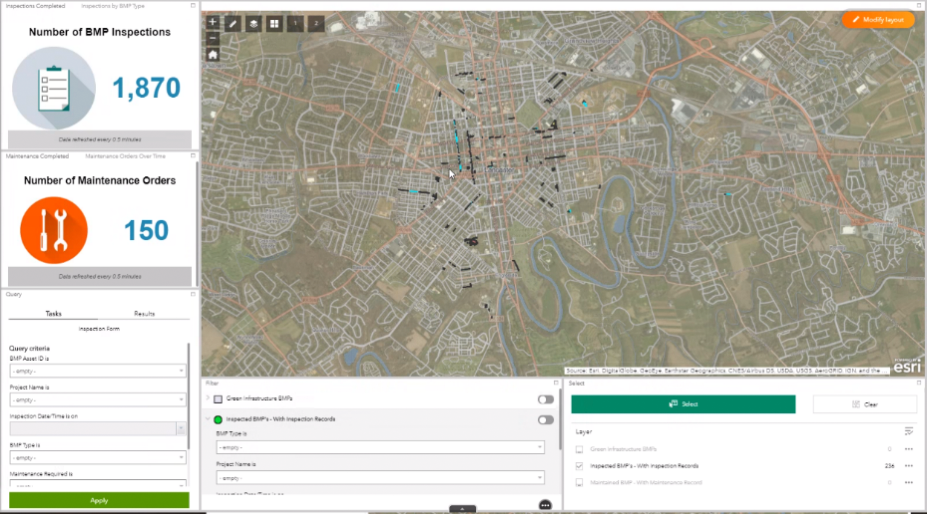
The City of Lancaster, PA has the task of conducting routine inspections, maintenance and effectiveness assessments on all the Green Infrastructure BMP’s that fall within the city limits. Until recently, they had been performing inspections and maintenance with the only record of completion being a field form filled out by hand. They would then have to hard enter this information into their system manually. With added pressure due to a recent overflowing of CSO’s during heavy storm events, they realized they needed a more efficient system of data collection and tracking. In pursuit of this goal, Terraphase stepped into to provide a seamless data collection system which would be intuitive, efficient and easy to manage.
Solution
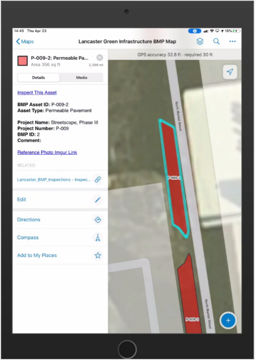
Terraphase developed a smart data collection solution on the ESRI ArcGIS Online platform that provides the user an intuitive form and required data. BMP Inspections and workorders can be planned out ahead of time using a dispatcher dashboard. The dispatcher will then easily be able to track the location and time required for inspections an>d workorders which in turn helps plan future events. Data validation measures were also put in place so that only pertinent data could be collected and required data was not missed. After submitting a BMP inspection, an automated email detailing required maintenance details is sent to the Green Infrastructure Stormwater team so that they can act quickly and get a workorder generated.
Mobile Data & Mapping
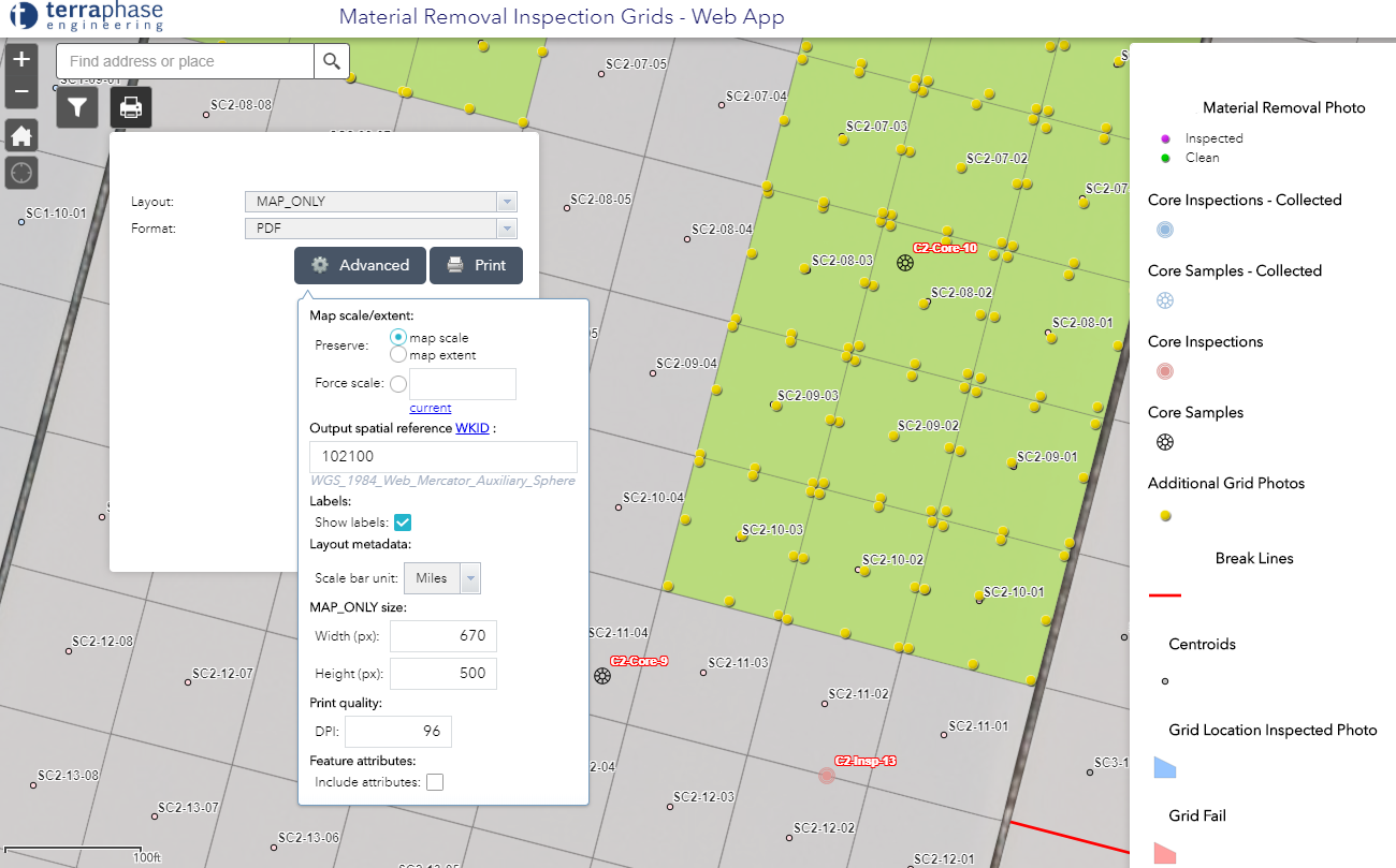
Smart data collection tools help guide soil removal project from the field
Read MoreKey Elements
- Real-time GPS data
- ArcGIS Online
- ESRI Collector
- Enterprise GIS
- Mobile forms
- Microsoft OneDrive™
Benefits
- Maximize efficiencies in data collection, storage and reporting
- Optimize investments in data
- Eliminate transcription errors
- Check/validate data entry
- Yield field note uniformity
- Easily find and report data
- Secure data sharing and access
Challenge
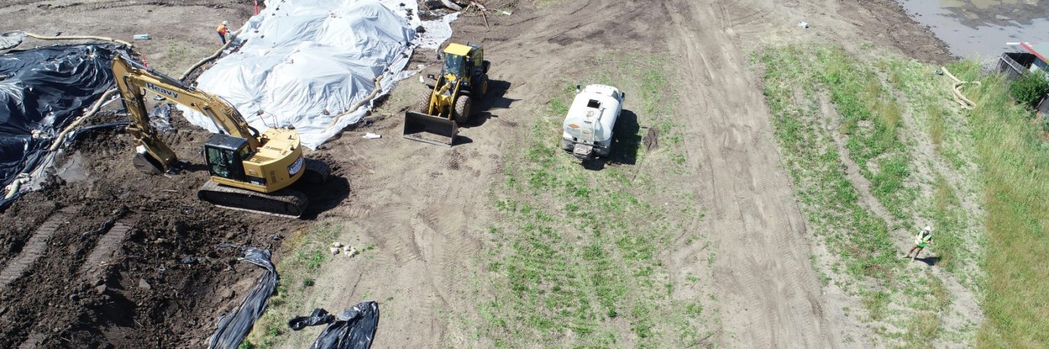
When activities at a packaging machinery manufacturer’s facility inadvertently impacted the soil of a large agricultural site , Terraphase was contracted to oversee and monitor earth removal activities at the impacted site. Terraphase determined an approach that would provide real-time data to help guide remedial activities on a day-to-day basis, with the goal of producing a defensible record of activities and data would be necessary.
Solution
By implementing a smart data collection approach utilizing interactive mapping, visual grid sampling, on-site sampling results, and uniform daily field reporting, Terraphase has been able to achieve the client’s goal by sharing data in real-time for on-the-spot decision making purposes and reduced field time.
- Intelligently collected data in the field on a mobile device to provide uniformity and validity of notes
- Effortlessly produced formatted daily reports delivered electronically to the client via email inboxes and/or secured OneDrive folders
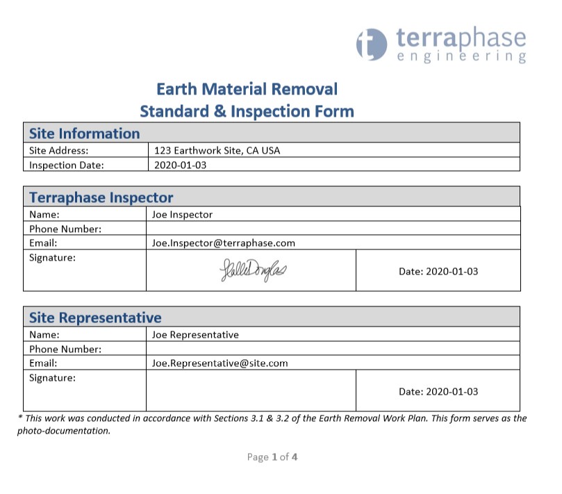
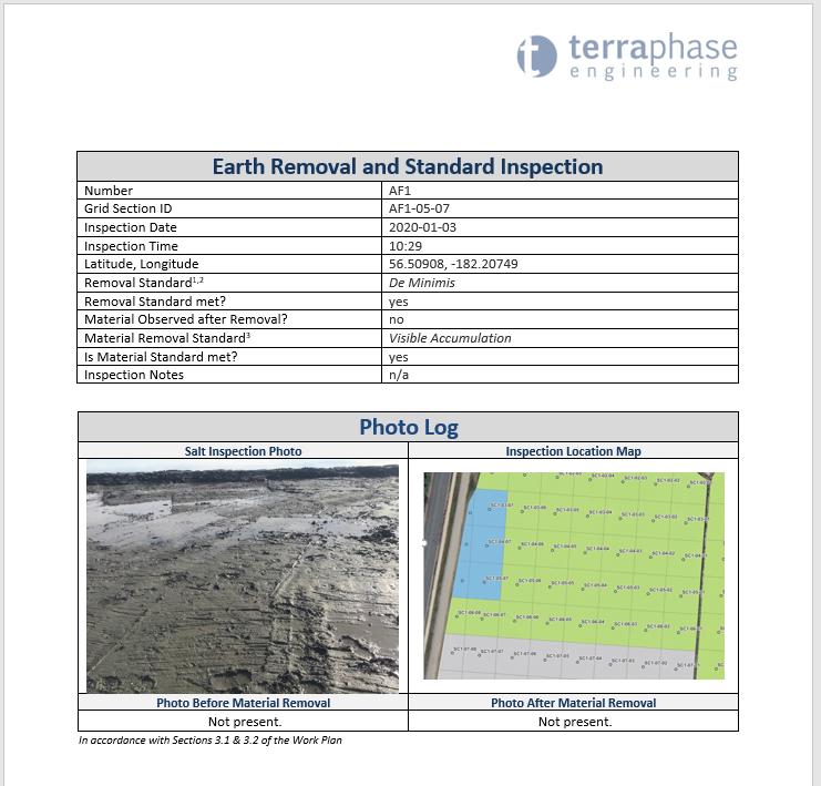
- Reviewed real-time data online at the office, printed maps, and produced a defensible record of daily activities and data
Key Elements
- Geographic Information Systems
- FAA Part 107 Licensed Staff
- Pix4D
Benefits
- High resolution real-time imagery
- Cross physical barriers, dense vegetation, wetlands and natural hazards
- Thousands of acres in a single day
- Photogrammetry
- Digital elevation models and georeferenced orthomosaics
Challenge
Phase 1 ESAs may be difficult in situations where Environmental professionals have limited access, due to either the size or condition of the subject property. In addition, finding historical aerials younger than several months old is not often possible.
Solution
Terraphase has cost effectively deployed unmanned aerial systems (UAS), aka “drones” in this situation. A UAS flight provides a high-resolution current “bird’s eye views” of the property as well as video footage, as the drone can be flown into areas over physical barriers to vehicular or pedestrian access, dense vegetation, wetlands and natural hazards. Fixed-wing drones can cover thousands of acres in a matter of hours. Quad-copter drones can easily cover smaller areas and more adeptly navigate certain features. Using drone outputs of several thousand small overlapping geotagged images, application of photogrammetry permits the construction of both 2D and 3D maps, digital elevation models and georeferenced orthomosaics that are then used in our Geographic Information Systems (GIS) as geotagged imagery for report figures.
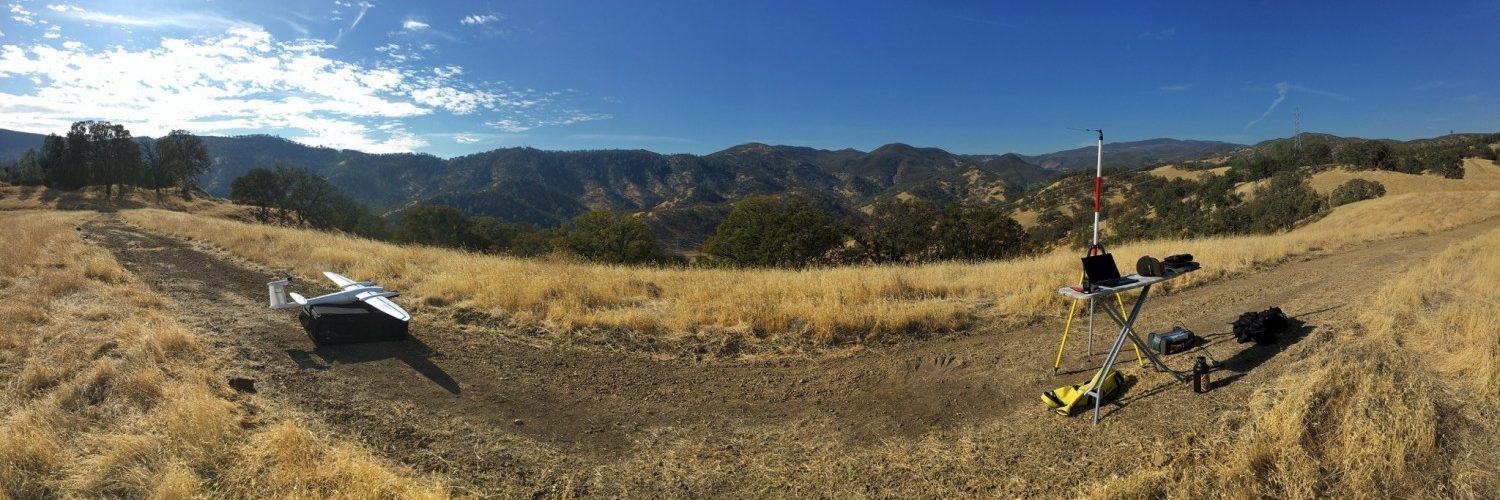
Launch site for fixed-wing drone flight over 2,000 acre site with rugged terrain in support of Phase I ESA
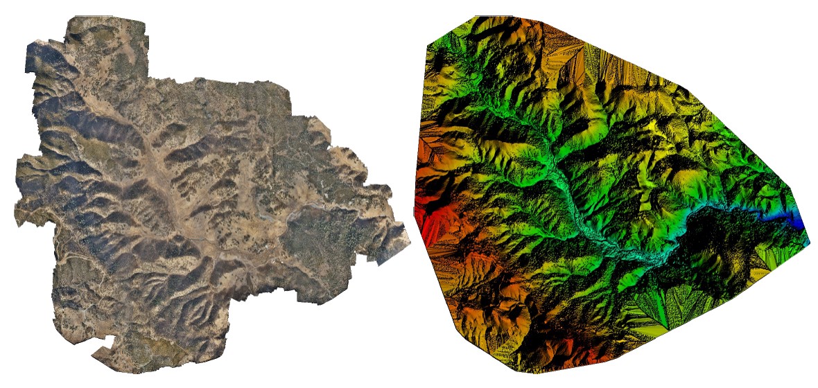
Orthomosaic and the Digital Surface Model(DSM) processing previews
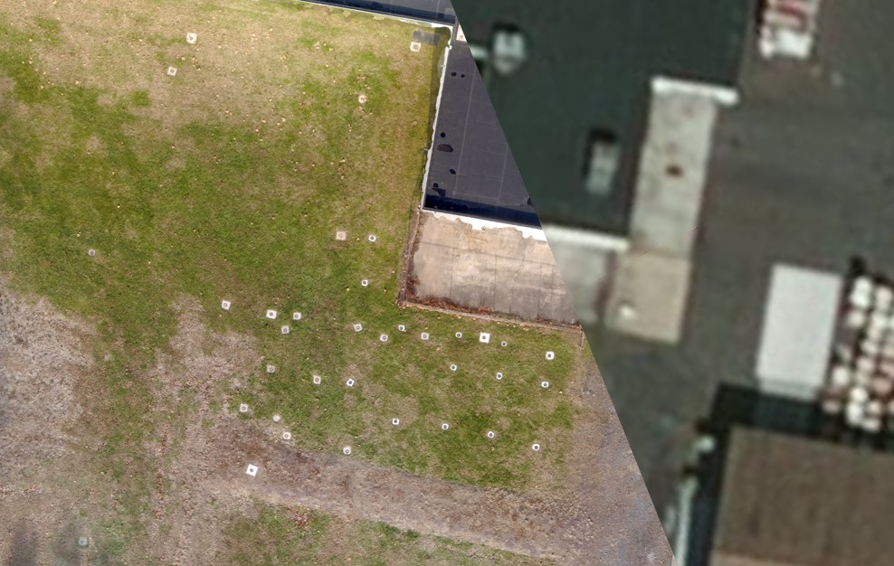
Side by side comparison of stock imagery compared to high resolution drone imagery of a site showing well pads that were part of a groundwater investigation
Key Elements
- Microsoft PowerApps
- Microsoft Flow
- SharePoint
Benefits
- Automated communication between stakeholders, project managers, and sampling team
- Cost reduction in project management hours
- Compliance timestamps for outlet preparation
- Fewer cancelled sampling opportunities
- Simple progress report data
Challenge
Testing for lead in drinking water across multiple school districts demands coordination and preparation on a massive level. Preparing water outlets for early morning testing requires a checklist to be completed on site prior to testing, and a record of the preparation be completed. The most cost-effective way to accomplish this is to have facility staff complete the preparation work the day before testing is required. However, the communication channels in coordinating facility staff to complete these tasks can quickly become a pitfall in these projects.
Solution
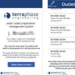
Terraphase designed a custom mobile application and automated messaging system to coordinate water outlet preparation for all schools. The day before water outlet testing is scheduled, facility managers and building engineers are contacted via the automated messaging system. The message provides them with instructions to use the mobile app and gives them a checklist for each water outlet scheduled to be tested. Problems with the outlets can be reported via the checklist. In the evening, our clients and the sampling team are automatically notified of the status of the water outlets, and sampling proceeds based on those notifications.


